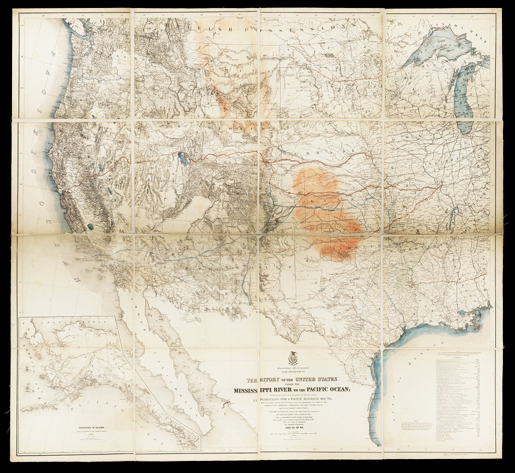
This map of United States territory from the Mississippi River to the Pacific Ocean was drawn between 1865 and 1868. The cartographer (mapmaker) drew the map based on secondhand accounts and other maps, but he updated this edition of the map to reflect information about new states and territories, like Alaska. The bottom right corner of the map lists the sources used to create it. The cartographer also added notes to the map to show information besides territorial boundaries, geographic features, and roads. For example, this map also shows railroad lines and buffalo ranges. These were added in colored pencil after the map was engraved and printed.
This resource is part of the lesson Perspectives on Westward Expansion.